The first step in offshore hydrocarbon exploration!
At TP-OTC, we take the first step of our offshore hydrocarbon exploration activities with our seismic research vessel and expert crew. In line with the report outcomes, we proceed to the next phase of our project.
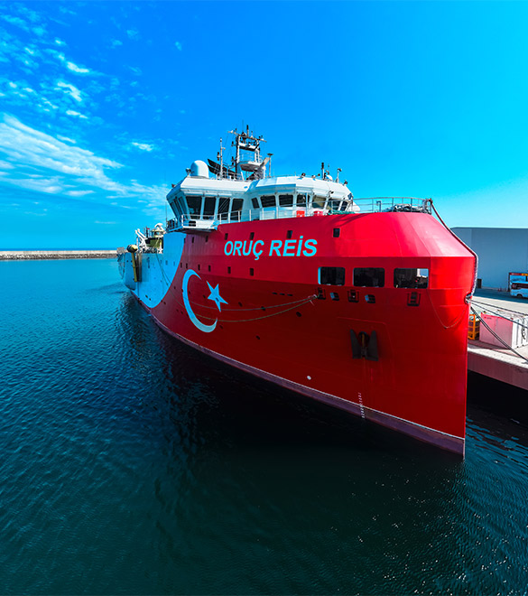
Our seismic research vessel Oruç Reis guides us in our offshore hydrocarbon exploration activities. The vessel is available for operations in both the Black Sea and international projects.

Our Oruç Reis Seismic Research Vessel is equipped with a 6x8 streamer configuration to examine the seabed and the geological structures beneath it in detail. Thanks to six parallel-configured streamers, each 8 km in length, it enables the collection of high-resolution data over extensive areas.
With our vessel, we can image geological structures down to a depth of 15,000 m below the seabed and, by means of our modern remotely operated underwater vehicle (ROV), we can monitor in detail the seabed at water depths of up to 1,500 m.
Our vessel acquires 2D/3D images of the rock formations and geological structures beneath the seabed. In this way, with the aid of hydrophone systems in the streamer cables, it measures the reflection times of sound waves from the seabed and underlying layers.
Our Service Areas
We operate in the depths of the sea
Revealing the potential of oil, natural gas, and mineral resources,
Conducting continental shelf analyses,
Performing earthquake risk analyses and mapping fault lines,
Carrying out geotechnical and geodynamic studies,
Identifying seabed morphology and sediment structure.
Key Data We Collect
3D Seismic Data: High-precision modelling of subsurface structures beneath the seabed
Geological Structure Information: Identification of oil, natural gas, or mineral deposits
Geotechnical & Tectonic Data: Analysis of fault lines, fracture systems, and geodynamic processes
Seabed Morphology: Analysis of seabed topography and sediment structure
Environmental and Physical Data: Oceanographic measurements such as water temperature, salinity, and sound velocity


Our Survey and Measurement Systems
2D/3D Seismic Survey Systems: 6×8 streamer configuration
Gravity & Magnetic Survey Instruments
Seabed Mapping Survey Systems
Geology, Geophysics, Hydrography, Oceanography & Biology Laboratory