We provide integrated subsea survey solutions!
At TP-OTC, we provide integrated subsea acoustic, geophysical, geotechnical, and environmental survey solutions to support our core competencies in marine energy, infrastructure and site selection projects.

With our advanced survey vessels, high-precision equipment and experienced personnel, we conduct in-depth analyses of the geological, geophysical, geotechnical, oceanographic, hydrographic, meteorological and environmental characteristics of the water column, seabed and subsurface layers.
Through these services, we deliver high-quality data of critical importance to inform decision-making during the exploration, field development, construction and operations phases.
Our Main Focus Areas
At TP-OTC, our core competencies lie in supporting offshore energy, infrastructure, and field selection projects through integrated subsea acoustic, geophysical, geotechnical, and environmental survey solutions.

Marine Geophysical and Hydrographic Surveys
Using multibeam echo sounders, LiDAR bathymetry sensors, side-scan sonars, sub-bottom profilers and magnetometers, we conduct high-resolution geophysical surveys. These surveys provide essential information on seabed morphology, geological structures and potential geological hazards, thus supporting safe design and route selection for offshore assets.
In addition, at TP-OTC, we offer offshore conventional and high-resolution 2D/3D/4D seismic data survey and data processing services in both deep and shallow waters.

Geotechnical Site Investigations
Our geotechnical services include seabed sampling, cone penetration testing (CPT), the use of gravity and vibro corers, and drilling operations to assess the physical and mechanical properties of seabed soils. These data are vital for foundation design, stability assessment, and risk mitigation in offshore construction.

Environmental Monitoring and Metocean Services
At TP-OTC, we perform comprehensive baseline environmental surveys and metocean measurements, including water and sediment sampling, current profiling, habitat mapping, and marine mammal observations. Through these services, we support regulatory compliance, environmental impact assessments (EIA), and sustainable marine development.

Pipeline Route and Cable Corridor Surveys
We are specialists in route engineering surveys for subsea cables and pipelines. By utilizing advanced AUVs (Autonomous Underwater Vehicles) and ROVs (Remotely Operated Vehicles), our surveys identify the most suitable installation routes, assess seabed conditions, and pinpoint potential obstacles or geological hazards.
These capabilities ensure that marine operations are planned and executed in a safe, efficient, and cost-effective manner.

UXO Detection and Risk Assessment
At TP-OTC, we can perform unexploded ordnance (UXO) surveys to detect and map hazardous remnants located on or beneath the seabed. To ensure accurate and efficient target identification, we use advanced detection systems such as gradiometer magnetometers integrated with ROVs or magnetometers mounted on AUV systems.

Advanced 2D and 3D Seismic Survey Solutions
At TP-OTC, we offer 2D High-Resolution, 2D Ultra High-Resolution and 3D Seismic Survey, quality assurance/quality control (QA/QC), data processing and interpretation services. We successfully deploy these services not only within Türkiye’s territorial waters, but also in many international offshore projects.

Data Processing, Interpretation, and Reporting
By utilizing advanced processing tools and GIS platforms, we deliver accurate, timely, and high-resolution data interpretations. Our integrated, high-quality reporting reliably supports engineering design, permitting processes, and operational decision-making. Reports are tailored to meet international standards and project-specific requirements, thereby ensuring clarity, consistency, and technical robustness.
General Offshore Survey Services
Deepwater Geotechnical and Geological Investigation
Nearshore Jack-up or Platform Construction Site Investigation
Shallow Water and Nearshore Geotechnical and Geological Investigations
Offshore Subsea Pipeline or Cable Route Surveys for Oil and Gas
Offshore Oceanographic Surveys
Seabed Geological Hazard and Shallow Geohazard Surveys
Subsea Equipment and System Installation Location Surveys
Autonomous Marine Environmental Monitoring Surveys
Offshore Geochemistry Surveys
Slope Stability and Sediment Transport Studies
Pre-lay and Post-lay Survey and Engineering, Visual Inspection and Monitoring
Deep and Shallow Water Geophysical Surveys
Subsea Observation and Positioning Surveys
2D/3D/4D Seismic Survey, Processing and Interpretation
Long-offset and Multi-azimuth Seismic Survey
Major Project

Sakarya Gas Field Development Project
As TP-OTC, within the Sakarya Gas Field Development Project comprising Phase I, Phase II and Phase III, we provide comprehensive services including Geophysical and Hydrographic Surveys, Pipeline Route Survey and Geohazard Assessment, Geotechnical Site Investigation, Environmental Monitoring and Metocean Studies, Route and Cable Corridor Surveys, as well as UXO Detection and Risk Assessment.

Kıyıköy Seabed Survey Project
Within the scope of the Kıyıköy Seabed Survey Project, we carried out marine geophysical and hydrographic surveys over an area of 7,007 km². These surveys included bathymetry, seabed profiling, and side-scan sonar studies. We also successfully delivered advanced 2D seismic survey solutions, providing 2D High-Resolution and 2D Ultra High-Resolution seismic services.
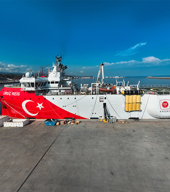
Somalia Offshore Seismic Survey Project
Within the scope of the Somalia Offshore Seismic Project, using the Oruç Reis Seismic Survey Vessel, we successfully completed 3D seismic surveys in three different blocks covering a total area of 4,464 km² within Somalia’s territorial waters.